Jewiki unterstützen. Jewiki, die größte Online-Enzy­klo­pädie zum Judentum.

Helfen Sie Jewiki mit einer kleinen oder auch größeren Spende. Einmalig oder regelmäßig, damit die Zukunft von Jewiki gesichert bleibt ...

Vielen Dank für Ihr Engagement! (→ Spendenkonten)

How to read Jewiki in your desired language · Comment lire Jewiki dans votre langue préférée · Cómo leer Jewiki en su idioma preferido · בשפה הרצויה Jewiki כיצד לקרוא · Как читать Jewiki на предпочитаемом вами языке · كيف تقرأ Jewiki باللغة التي تريدها · Como ler o Jewiki na sua língua preferida

Datei:Zambia.A2004112.0845.721.250m.jpg

Aus Jewiki
Zur Navigation springen Zur Suche springen

Originaldatei(2.871 × 3.131 Pixel, Dateigröße: 4,58 MB, MIME-Typ: image/jpeg)

Diese Datei stammt aus einem gemeinsam genutzten Medienarchiv und kann von anderen Projekten verwendet werden. Die Beschreibung von deren Dateibeschreibungsseite wird unten angezeigt.

Beschreibung

Beschreibung

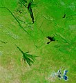
Seasonal flooding in Southern Africa (false color) CROPPED TO CENTER ON CAPRIVI The rivers of southwestern Africa are overflowing with excess water from a wet rainy season in this true and false color image pair, acquired by the Moderate Resolution Imaging Spectroradiometer (MODIS) on NASA’s Terra satellite on April 21, 2004. In both images, the flood water is black against the green background of surrounding vegetation. The rivers flood regularly, but this year’s floods were more extensive than normal.

Three regions of flooding are shown in this scene. On the left side of the image near the center is the long, north-south-running Zambezi River. This section of the river runs through Zambia before curving east in Namibia’ Caprivi Strip. In Namibia, the river has flooded again, creating a large oval of dark flood water in the eastern tip of the country. Southwest of the Zambezi floods is the Okavango River Delta, which resembles the tangled roots of a plant. The dark water spreading beyond the green banks of the river suggests that the Okavango Delta may also be flooded.
Datum Visualization Date 2004-04-27
Quelle http://visibleearth.nasa.gov/view_rec.php?id=6927
Urheber Credit Jacques Descloitres, MODIS Rapid Response Team, NASA/GSFC
Genehmigung
(Weiternutzung dieser Datei)

NASA Terms of Use For all non-private uses, NASA's Terms Of Use are as follows:

The imagery is free of licensing fees NASA requires that they be provided a credit as the owners of the imagery Visible Earth Addendum Beyond the NASA Terms, the Visible Earth team requests, but does not require:

The Visible Earth be provided a credit as the location that the imagery was found at

A URL be provided, either to the Visible Earth (http://visibleearth.nasa.gov/) or to the page providing the link to the used image.

Lizenz

Public domain Diese Datei ist gemeinfrei (public domain), da sie von der NASA erstellt worden ist. Die NASA-Urheberrechtsrichtlinie besagt, dass „NASA-Material nicht durch Urheberrecht geschützt ist, wenn es nicht anders angegeben ist“. (NASA-Urheberrechtsrichtlinie-Seite oder JPL Image Use Policy).
Warnung:

Kurzbeschreibungen

Ergänze eine einzeilige Erklärung, was diese Datei darstellt.

In dieser Datei abgebildete Objekte

Motiv

Dateiversionen

Klicke auf einen Zeitpunkt, um diese Version zu laden.

Version vomVorschaubildMaßeBenutzerKommentar
aktuell15:35, 27. Mai 2007Vorschaubild der Version vom 15:35, 27. Mai 20072.871 × 3.131 (4,58 MB)commonswikimedia>Foundert~commonswiki{{Information |Description=Seasonal flooding in Southern Africa (false color) CROPPED TO CENTER ON CAPRIVI The rivers of southwestern Africa are overflowing with excess water from a wet rainy season in this true and false color image pair, acquired by the

Die folgende Seite verwendet diese Datei:

Metadaten